Bethany Hughes: Thru Hiking 20,000 Miles For a Cause
August 16, 2016

Words & Photos by Bethany "Fidgit" Hughes // Her Odyssey
Distance: 101 Miles (162.5 km)
Duration: 7 - 11 Days
Level: Challenging
Access: Villa O'Higgins-Cochrane, Chile
Season: December - February
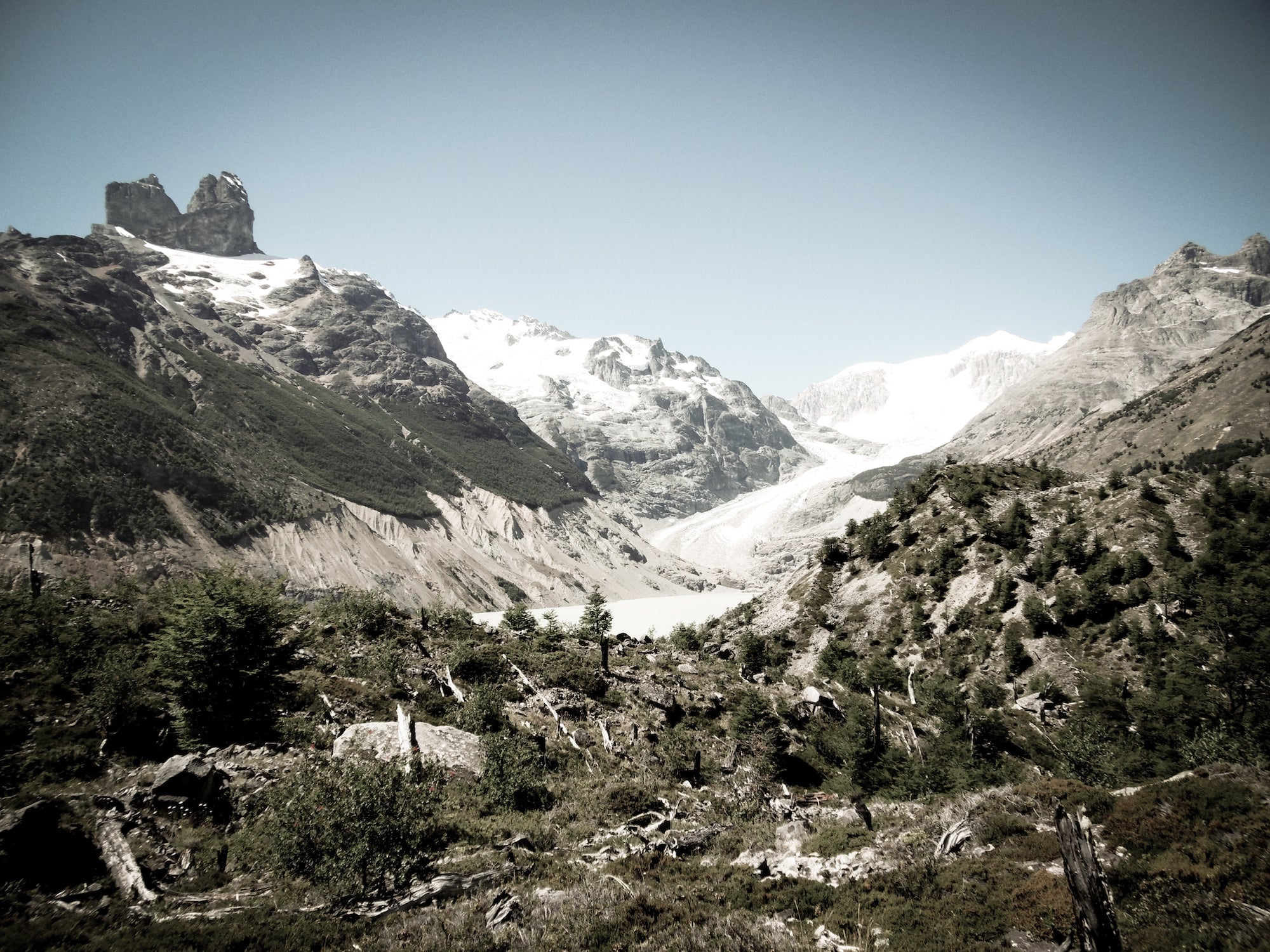
This ‘Ruta Patrimonial’ of Chile is already incorporated into the far wider Greater Patagonian Trail. It's generally agreed that the “Ruta de Los Pioneros” is one of the most astounding sections of that region, and it sees very few hikers each year. With intertwining and disappearing trails that cross through river fed glaciers and wind past the glaciers themselves, and a portion that even pops into a corner of Argentina, this remote and austere trail is only recommended for highly experienced trekkers. Ample GPS experience is a must, and those who choose to embark on this trip must be comfortable with carrying up to nine days of food.
The Ruta de Los Pioneros can be accessed either from Chochrane, Chile in the north or from Villa O’Higgins in the south. If you prefer to avoid a walk on a lightly-trafficked 27-mile dirt road, a transport can be arranged from either town to their respective trailheads. The 47 miles in the middle are pure trail and route finding.
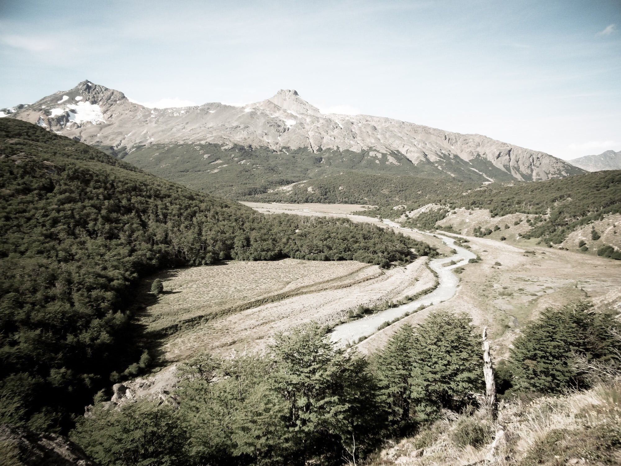
The trail portion of the route (from South to North) begins alongside Lago Christie, delving straight into a thicket of shrubs with trails marked only by cairns. It follows along and above two lake shores, through areas where the wagons and horse hooves of the earliest pioneers to settle the area trekked through over 100 years ago. This area has seen some work by the Chilean government – there are some poorly-maintained bridges through the marshy areas, and some new refugios built near the lake which are open and free to camping. This option is inviting considering the tempestuous nature of Patagonian climate.
After the two lakes, the trail follows serenely through a forest and past the last of the two puestos along this route. Less than a mile past the puesto, the trail fades noticeably, but generally follows up along a river where, as the gaucho from the last puesto, the famous Don Rial, puts it, “Crucas donde nace el rio,” (“Cross where the river is born”). Depending on the time of year, you may see worn approaches crisscrossing the river which is usually the work of horseback riders. As a walker, you can generally stay to the right of the river until just below the lake where it begins. The next several miles see a number of high river crossings which can be impassable or dangerous in the early season.
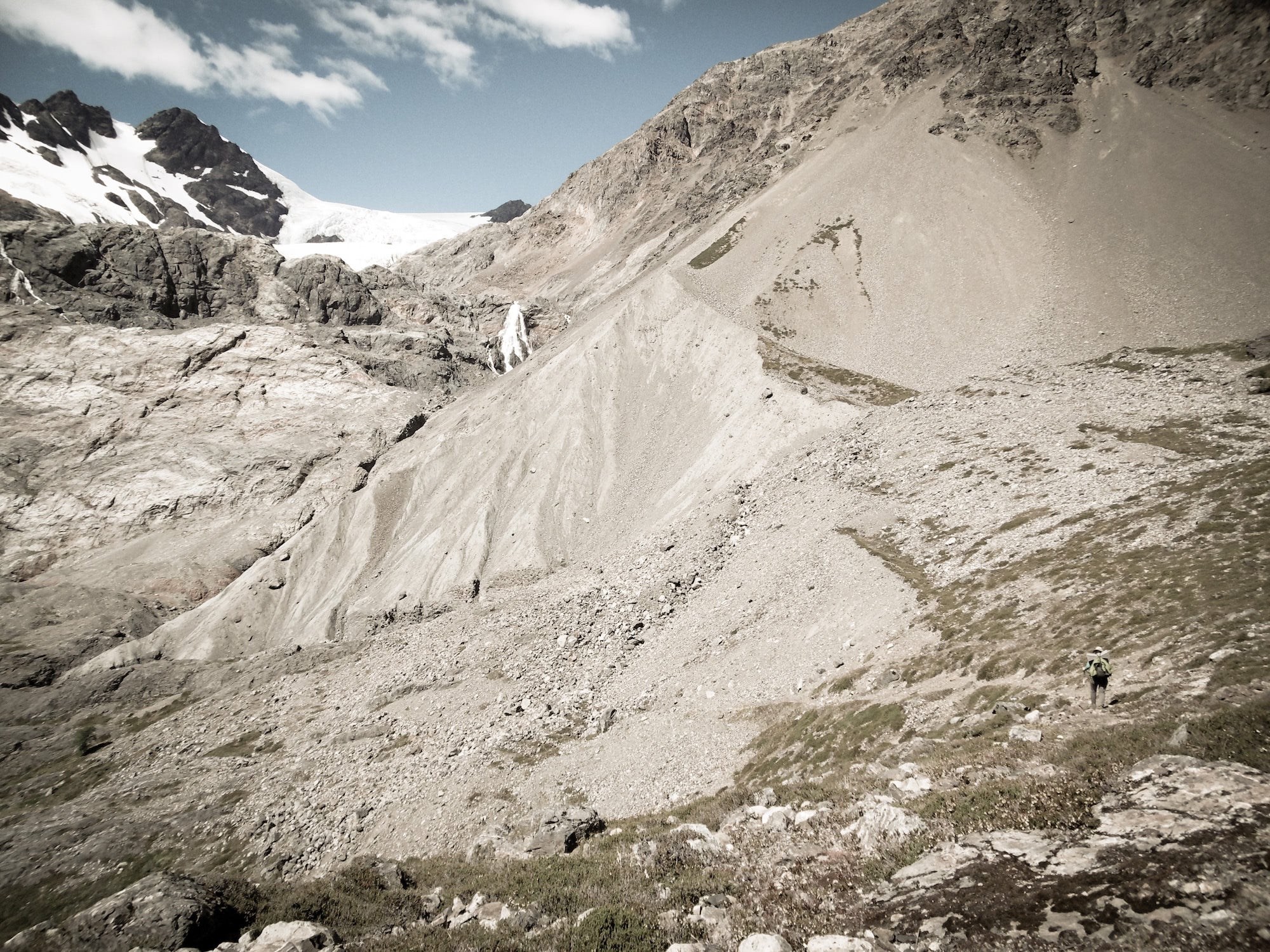
Crossing here, the route climbs through a wandering rock field, again marked only by pircas (cairns). Crossing a river that roars straight out of a glacier, you'll continue to climb into a barren alpine environment where technically you'll tap Argentina before pushing up over the pass, El Paso Pedregoso.
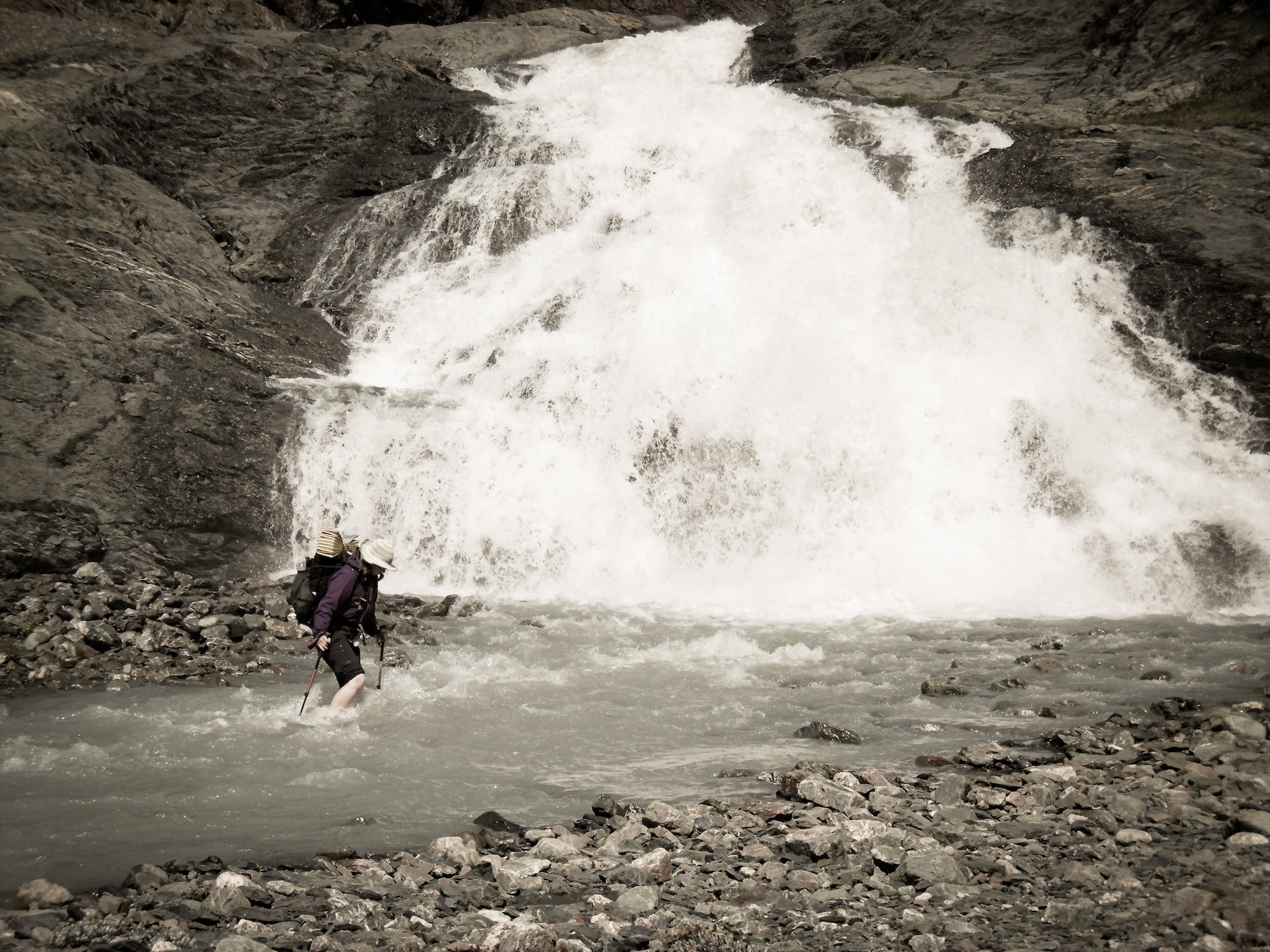
After the pass can be a tricky point. A few miles down is a lovely campsite with a wide and very obvious trail leading down to a difficult and dangerous river crossing. From the campsite, search uphill instead. The thicket should open up to a grassy rise which may be followed through a meadow and again into a thicket. Once through this, you'll be following a clear trail again that's cut into a precipitous mountainside. This descends to the valley floor where you cross a braiding of rivers, and there are a variety of beautiful campsites.
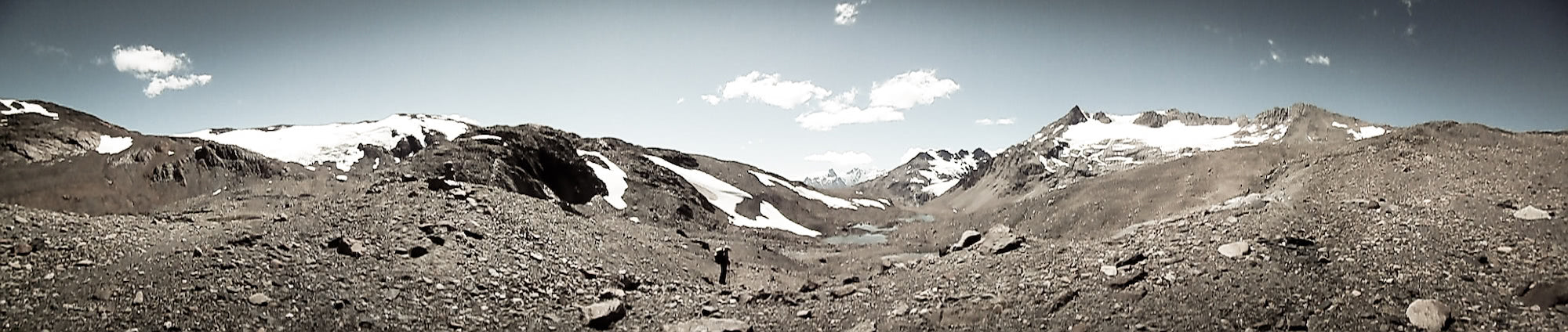
The valley continues becoming more and more domesticated, concluding in a beautiful meadow of abandoned puestos and wildflowers. Monte San Lorenzo will have stood out for you ever since cresting the pass, and soon you'll see Glaciar Cualluqueo, signaling your arrival back to a stretch of road which leads into Cochrane.
A few notes:
For a detailed route track, check out this Wikiexplora page.
If you do hike this route, it is customary to bring a gift for the Huasos who will happily share directions and guidance, or even just a friendly wave. Gifts can be trinkets from your home country (patches, sweets, small flags), and fresh foodstuffs from town, etc.
Bethany “Fidgit” Hughes has been using and (rigorously) testing our 3400 Southwest Pack, Echo II Shelter System and a variety of Stuff Sacks + Pods since the beginning of the Her Odyssey journey from South America to Alaska in 2015. She is constantly posting insights, photos and videos from the trail – so make sure you give Her Odyssey a follow on Facebook and Instagram.
YOUR CART IS EMPTY
Let’s find you the right gear for
your next adventure.