Snow Daze: Thru Hiking the PCT in 2017
February 23, 2017

April 1 Snow Pack Update: Thru Hiking the Pacific Crest Trail Isn’t Getting Any Less Interesting
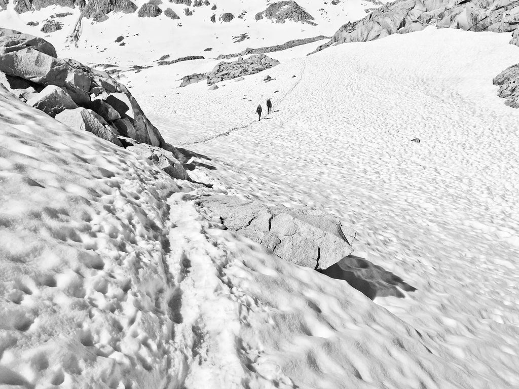
Five weeks ago we published a Pacific Crest Trail 2017 preview, and it turns out that we’re not alone in having a mean case of trail brain right now. The post caused quite a stir simply (we think) because it accurately related the insane reality of the Sierra snow pack at the end of February. A quick summary: if you’re thru hiking the Pacific Crest Trail this year, be prepared for snow. Lots of it.
Now for the update: As of April 1, the snow pack for the entire Sierra region of California is at 164% of normal. Break that down regionally and the numbers get even more staggering. We’re talking 147%, 175% and 164% for north, central and south, respectively.

The 2017 snow pack is the 11th deepest since 1950, and the deepest since 2011. According to the exceptionally thorough blog WeatherWest.com, California is also on track to having its wettest year on record. What does that actually look like on the trail? Well, Mammoth Lakes—a place that knows a thing or two making the most of epic snowfall—recently had to enlist the National Guard to dig their downtown out. They got so much snow this winter that Mammoth Mountain had to limit operations and close lifts, so much snow that they simply ran out of places to put it. For reference, the PCT passes within six miles of Mammoth Mountain.
In March, due to some warmer-than-average temperatures during recent storm cycles, the snow level drifted upward. That means that, say you were driving from LA or San Francisco up into the mountains, it would look like there’s actually not that much snow at middle elevations. Looks, as they say, can be deceiving though. Keep driving, and once you get to higher elevations—up to where the PCT runs through the High Sierra or Lake Tahoe area—and entire buildings are buried.
Checking in with the PCTA this week to get an update on the actual on-trail situation, that dynamic seemed to present the most potential for problems this season. There’s a lot of people, especially aspiring north-bound thru hikers, who just don’t know how much it’s not “business as usual” on the trail right now.
It’s partially due to the common misconception that California is all beaches and palm trees, not burly, snow-capped mountains and treacherous passes. The Pacific Crest Trail starts in Mexico! That means it’s hot and paved with buckets of Coronas, right?
Arguably, people whose trip planning doesn’t progress beyond the “reconciling common misconceptions” phase should not be thru hiking the Pacific Crest Trail. That doesn’t mean that they won’t, though. Still, that doesn’t mean you have to be one of them.
How do you avoid that? Well, you’re here reading this—that’s a good start. Hopefully that means that you’re in the midst of a pretty serious trail information binge. As we all know, good planning is what good trips are made of.
So let’s get down to brass tacks.
Thru hiking the Pacific Crest Trail in a heavy snow year is not impossible“It’s going to be a challenging year,” says Jack “Found” Haskel, the PCTA’s Trail Information Specialist (again, dream job status). At the same time, he wants to remind people that while there is real risk, for people who have what it takes, it could even be fun. “I hiked the PCT in a heavy snow year” he recounts with something resembling nostalgia, “and it was an amazing experience.”
It all ultimately boils down to your skills, level of experience and tolerance for risk. Jack explains, “For people who are physically fit, knowledgeable and experienced, with the right equipment and can manage and tolerate real risk, it’s probably attainable. Some people do extreme stuff while playing in the wilderness—more extreme than you’re likely to encounter in the Sierra this year. Short, I should say, of some of the stream crossings.”
Know what you’re getting yourself intoAnother gem of knowledge from Haskel: “Know the risk so you can mitigate the risk.” When people are just heading out and don’t even know what they don’t know, that’s the problem.
In a year like this one, it’s not a matter of if you’ll come up against a major obstacle, it’s a matter of when. And the associated risks are very real indeed. On February 4, the Los Angeles Times reported that five day hikers tumbled down an icy chute at Islip Saddle, where the PCT crosses the Angeles Crest Highway. One hiker died, the others were hospitalized with serious injuries.
Let that sink in: someone has already died on the PCT this year because they fell on a steep snow slope. Further out, on a remote stretch of trail, even a minor accident can have similar repercussions.
A huge component of a successful thru hike in 2017 will be timing. “This year we’ve got a bunch of hikers heading out early, and I’m worried about them,” says Haskel. The PCTA issues up to 50 permits for thru hikers to leave each day to stagger the trail load. Typically, the dates from mid-April through early May fill up first. That’s precisely because savvy hikers are looking to get through the desert before it gets too hot, while also giving the snow enough time to melt in advance of their arrival in the Sierra. People who don’t plan far enough in advance get pushed, either early to the beginning of April or late to the last weeks of May and beyond.
This year, the first dates to fill up were right around April first. When pressed, Haskel theorized that a few factors are responsible; 1) The previously mentioned lack of general awareness of the snow situation and the associated realities, 2) some people wanting to take their hikes very slowly and 3) everyone just being very excited.
The recent surge in popularity of the trail, plus the proliferation of mediocre information on Facebook and other social media may be to blame. Simply put, any recommendation to start the trail early should come with a huge asterisk (which fittingly looks kind of like a snowflake) and a footnote regarding the up-to-the-minute realities of the snow pack in bold.
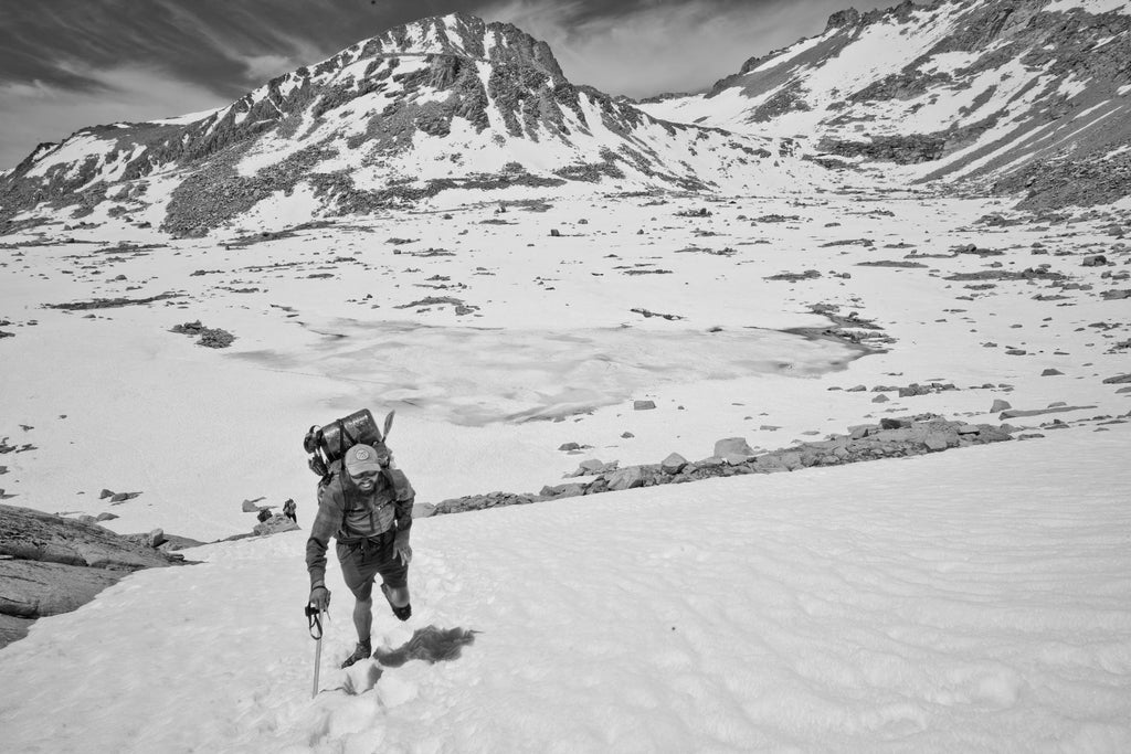
Early birds are likely to encounter some snow on high peaks in Southern California (Fuller Ridge of Mt. San Jacinto, Big Bear, Mt. Baden Powell and the rest of the Angeles Crest) and a ton of snow in the High Sierra. Things get real north of Kennedy Meadows.
June 15th is an early date in a normal year to head north from Kennedy Meadows. Anything before that is probably going to be a little crazy this year.
– Jack Haskel, PCTA
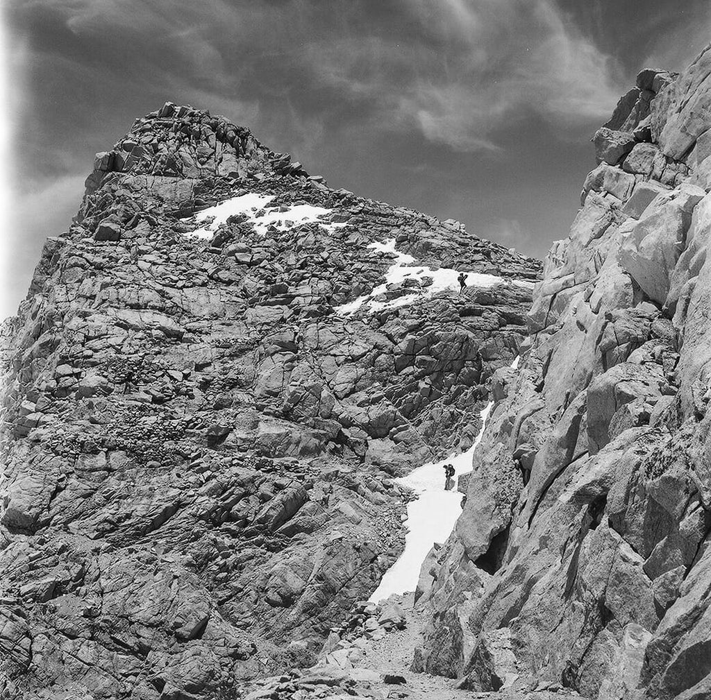
For northbounders, the areas that will cause the biggest challenges in the form of light mountaineering-type scenarios are Mount Whitney, Forrester Pass, Glen Pass, Mather Pass, both sides of Sonora Pass, Raymond Peak and Dicks Pass. North of there, from Truckee on will typically have dried out most years. However, given the current state of the snow pack, hikers arriving in Truckee on the early side—around July 1st—can expect to snow travel all the way up to Old Station, California.
Have the right equipment and know how to use it
Anyone thru hiking the Pacific Crest Trail early in the season is going to need to bring a few key pieces of snow safety equipment. They’ll also most likely need to tweak their standard gear list, even if they’re going ultralight.
Ice axe: Everyone should carry an ice axe to be ready for the high angle, exposed areas mentioned above. A slip in any of these areas—even at the height of summer—could mean a high-speed slide resulting in serious scrapes, cuts, bruises or worse.
You’re going to want a straight shaft axe that’s sized according to your height. A good rule of thumb is that the spike (the pointed tip of the shaft, as opposed to the pick) should just touch the ground when you hold the axe with your arm hanging straight down.
Just having an axe isn’t enough; you also have to know how to use it. This video on how to self-arrest from our buddy Dave Collins of CleverHiker.com is great place to start. From there you can go down quite a YouTube rabbit hole if you search for “ice axe self-belay” and “ice axe self-arrest.”
If you have a 2017 PCT thru hike in your sites and you’ve never done any of this stuff, you may want to take a basic mountaineering skills workshop. The American Mountain Guides Association is a great resource for finding local workshops and guides in your area. Pro tip: Ask a prospective guide what their certifications are, and ask to see their commercial use permits for operating on public land to separate the wheat from the badass-mountain-bros-posing-as-guides.
Also, you’re going to want to practice. As Dave demonstrates in the video, you become a nylon clad bullet in no time at all on a snowy slope. Self-arresting is serious business. Especially with a backpack on.
Hiking crampons: No, Microspikes are not enough. The PCTA consulted with Kahtoola, the company that sells the popular Micro and Nanospikes to develop a set of crampons engineered specifically for the needs of PCT hikers. They’re light-ish (at 21.4 oz. they’re technically the lightest steel crampon on the market), and they’re not cheap, but neither is a ride in an evac helicopter.
You’re also going to want to learn how to use these. Especially in relation to self-arresting and self-belaying.
That’s the mandatory stuff. The good news? If you’re planning on a Hyperlite Mountain Gear Southwest pack for your thru hike (our best recommendation for the PCT), we’ve got you covered with an ice axe loop and plenty of easy-access crampon storage. Even better? You should be able to ditch that stuff once you get north of Old Station, dropping something like two pounds in one fell swoop.
Gaiters: As for optional gear, consider some gaiters. You should be able to get away with sticking to the trail runner script even in a high snow year, depending on your threshold for cold, wet feet. Moisture absorption via a fabric medium is one thing. Constantly having actual snow granules rubbing up against your ankles in your shoes is another. There are a variety of lightweight gaiter options on the market that, like hiking crampons, should work with running or hiking shoes. Waterproof socks are another consideration, one that people usually have strong feelings about (as in, “I love ‘em” vs. “What’s the point? My feet end up soaked with sweat instead of water.”).
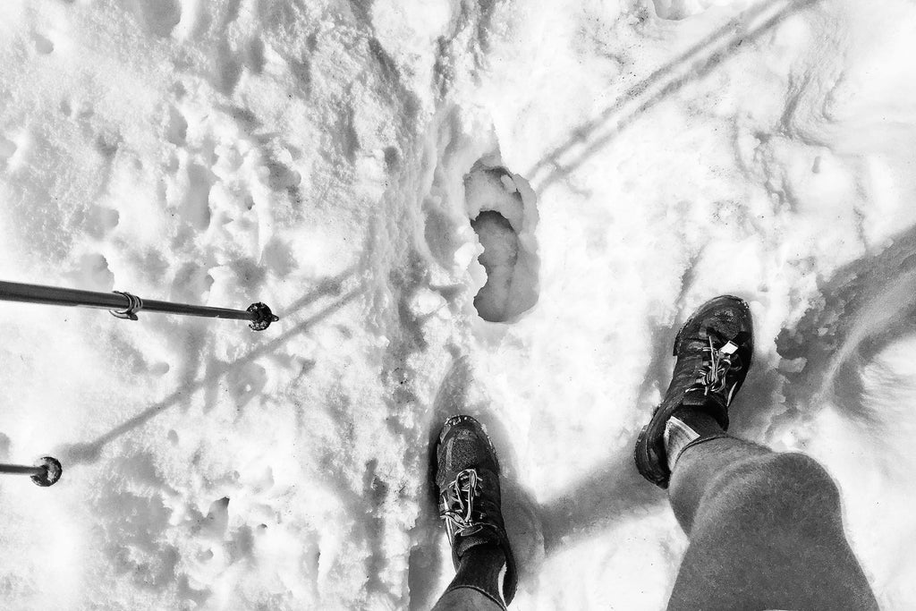
Pants: Yeah, you’re probably already packing them, but we just wanted to make sure. Post-holing all day in shorts is one of those experiences that can turn a great trip into a terrible one. Knees ringed with snow cuts are way worse than hot calves.
Of course, the elephant in the room with all this snow talk is that snow may not actually be your biggest problem on the Pacific Crest Trail this season. It’s what comes after snow—snow melt—that’s potentially more dangerous.
There’s no special skill set, no silver-bullet piece of gear that will get you across absolutely every stream scenario possible. Some swiftly moving water will just not be crossed by a human being relying solely on his or her two feet. Yes, trekking poles help, but you do not want to get swept away into a bunch of hazards in the middle of nowhere.
Again, Jack Haskel of the PCTA:
I’d like to emphasize that the stream crossings are going to be burley, so carry extra food and be willing to turn around. Don’t take unacceptable risks. If you get to a crossing and it looks like it’s too much, just turn around. Use maps that have bail out routes, have extra food so you’re not forced to keep going north and be willing to bail if you need to.
Be super cautious with these stream crossings. I worry that too many people are being swept downstream and ending up with “near miss” stories. People are looking for a safe place to cross, barely finding one, and going for it anyways. That means that they’re crossing in a questionable place or across a questionable log and the run out is death. Your crossing is not safe if the run out isn’t safe.
For some, this will all be too much. It’s totally ok to bail. Seriously. For others, it’ll be mostly manageable. Know where you fall on that continuum, and stay tuned for more updates on the on-trail situation from the PCTA here on the Hyperlite Mountain Gear blog.
We’d like to the Pacific Crest Trail Association for sharing their resources and knowledge with us. Hyperlite Mountain Gear is proud to support the PCTA and the great work they do for the thru hiking community on the Pacific Crest Trail.
If you’re not already a member of the PCTA, please consider joining.
YOUR CART IS EMPTY
Let’s find you the right gear for
your next adventure.